SORRY, THIS PROPERTY HAS BEEN SOLD.
This huge 81 Acres at the Lake of the Ozarks has trails, paved and gravel road access, lake views AND even a small bit of cove frontage at the end of a cove (not enough water for a dock).
This is a rare property having so much acreage yet still so close to the lake! We have priced this property as raw acreage so the “lakefront”, paved access, lake views and small creek are all just a BONUS!
This 81 acres is technically “lakefront” because it does have some frontage at the very end of a cove. Since the water is so low at the end of the cove you would not be able to have a dock on this property. In fact, in the winter when they drop the lake level the water would be several hundred feet from the property.
The sales price on this 81 acres is $119,500. As you know, most of our properties are available with a $500 down payment but on this LARGE tract the minimum down payment is $1,500. With $1,500 down the interest rate will be 7 3/4% and the payment will be $1,115 a month. With $2,500 down the interest rate drops to 6 3/4% and the payment drops to $1,040 a month. With $5,000 down the interest rate drops to 5 3/4% and the payment drops to $995 a month. These payments are all based on about a 15 year payment schedule. Property taxes are onlyabout $285 a year and are current. There are no prepayment penalties, no hidden fees and no balloon payments.
PLEASE NOTE that you have a full 12 months to ADD to your down payment in order to reduce your interest rate and payment amount!
We do need a minimum down payment of $1,500 on this huge tract of land and with your down payment you will automatically get the reduced interest rate of 7 3/4%.
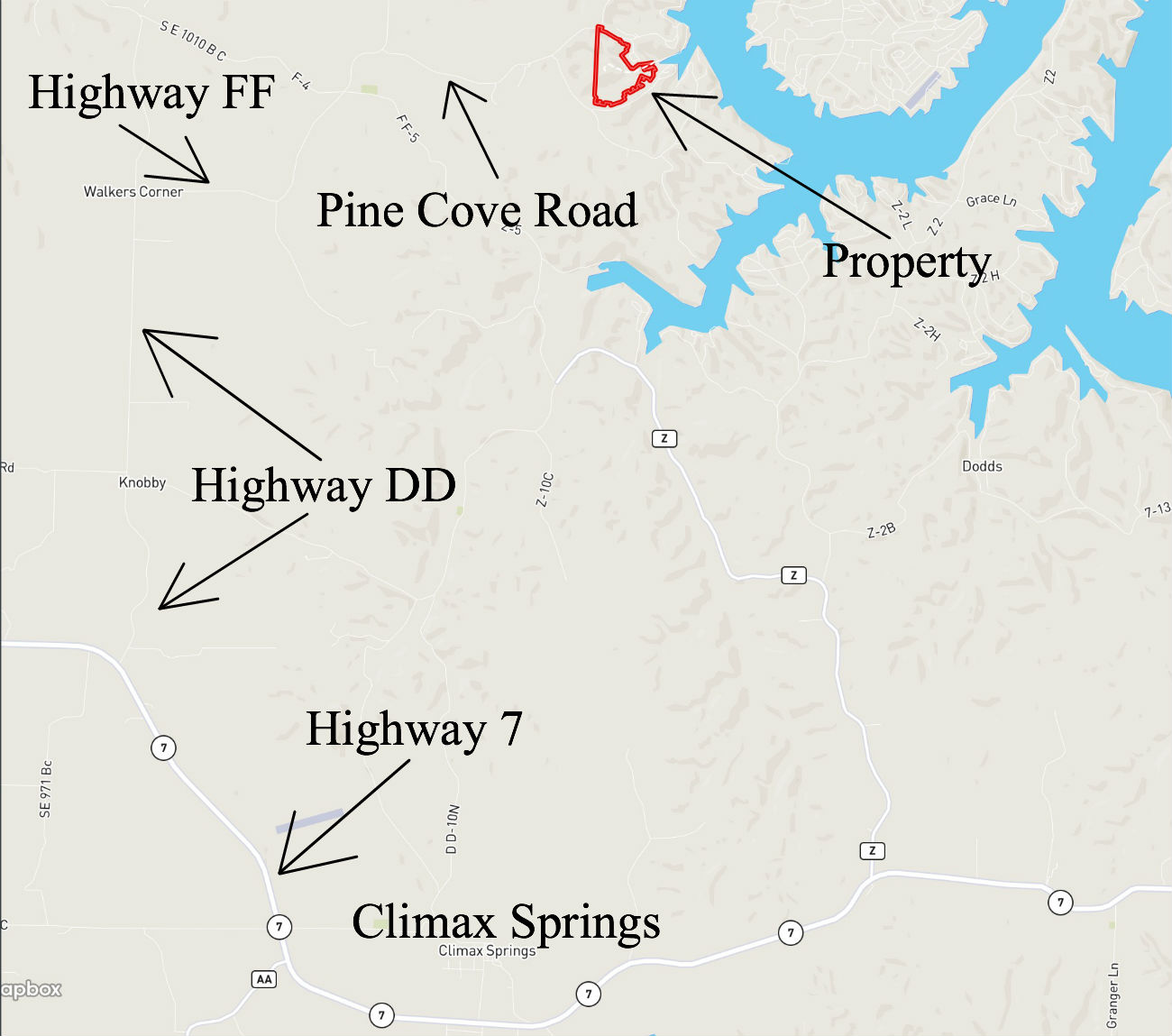
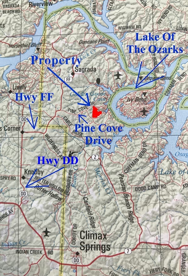
This property is located in Camden County, Missouri and is about 30 miles northwest of Camdenton which is the county seat. Lake Of The Ozarks offers fantastic fishing, boating and recreational opportunities.
In this listing you will see a mixture of winter and summer pictures/videos. The winter pictures/videos are a few years old and were taken right after the property was logged. The summer pictures/videos are more recent.
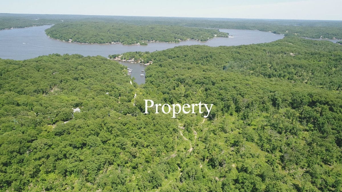
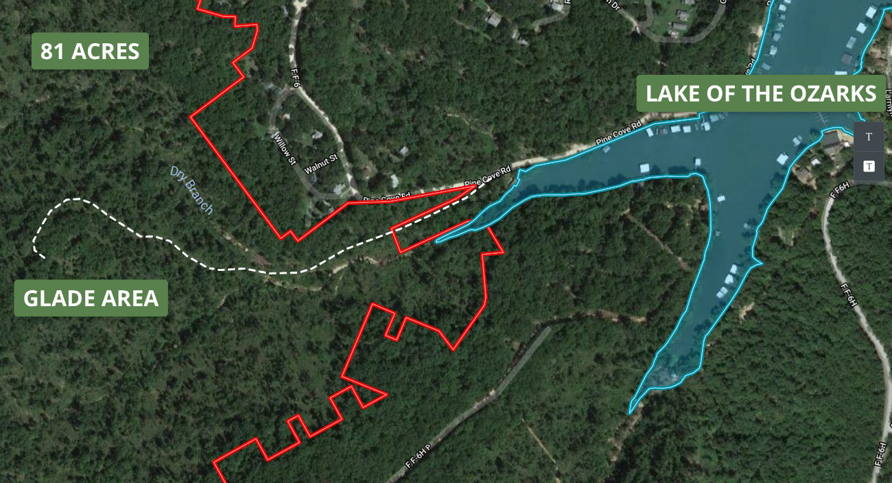
In the photo above we are looking easterly over the property toward the lake. The property has a small bit of frontage at the very end of the cove but there would not be enough water for a dock.
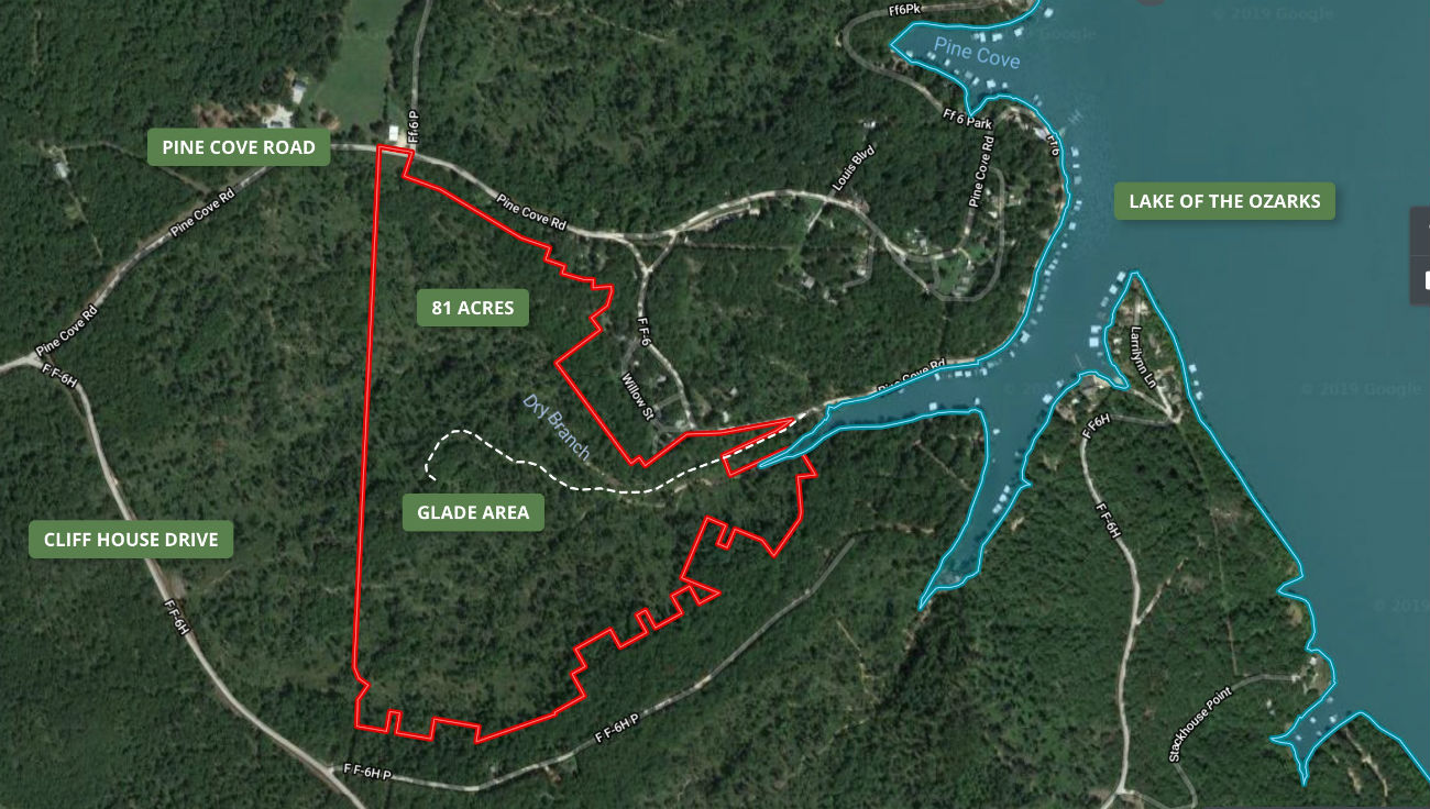
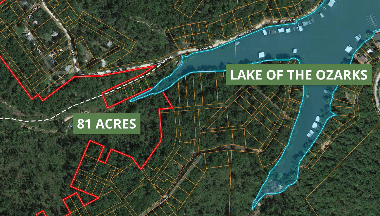
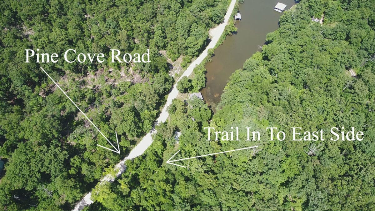
The aerial photo above shows the property as well as the Lake Of The Ozarks. The property has paved frontage on Pine Cove Road on its north side and it has gravel road frontage on its northeast side near the lake (also Pine Cove Road). The dotted line on the map is one of the many trails you will find on the property.
The Property was logged several years ago of the larger commercial oak trees. Parts of the property appear to have been logged heavily and parts of the property were not touched at all. It was not clear cut.
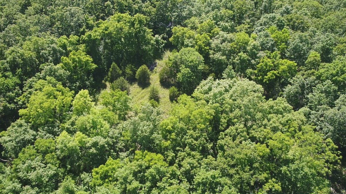
Pictured above is the glade area on the property. The glade and the area around the glade are gorgeous and may be an amazing site for building or camping.
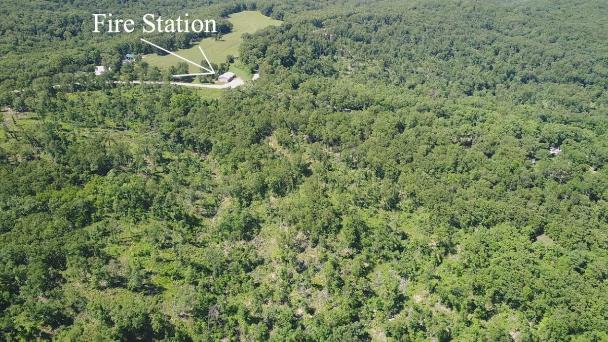
In the aerial photo above we are looking north over the property. The Fire Station is on the other side of the road from the north side of the property.
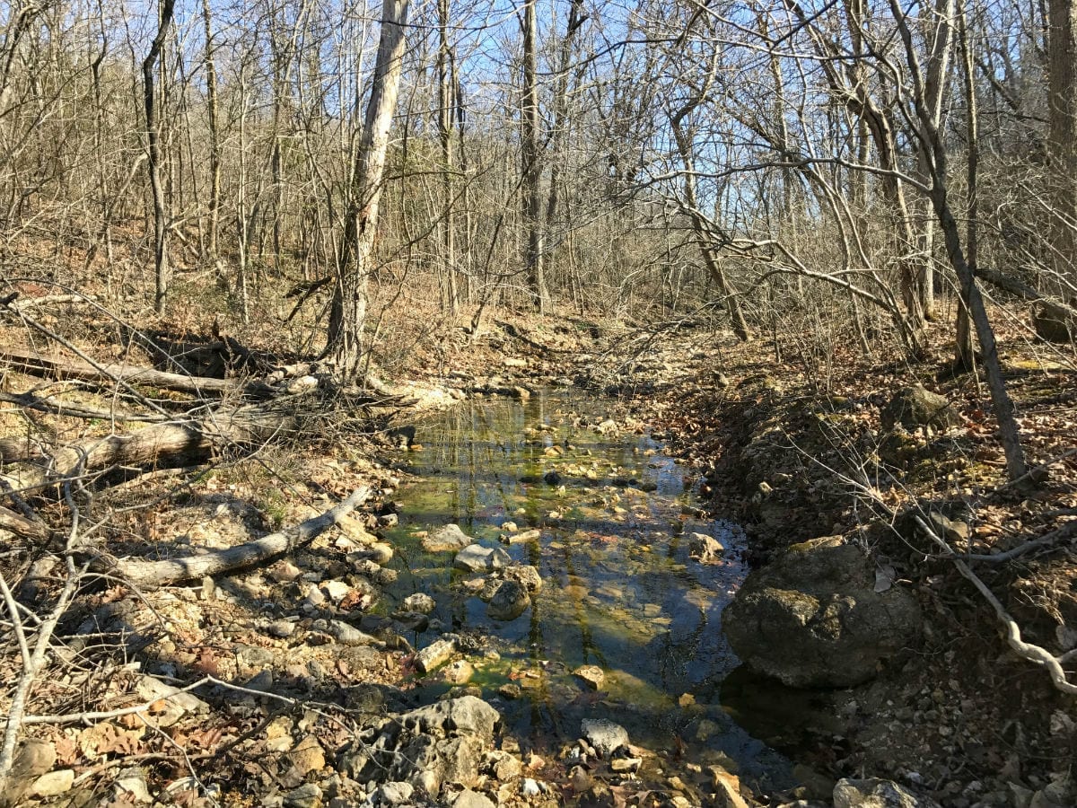
In the photo above we are looking at part of the small creek which runs across the property and into the lake. This photo was taken from the east end of the property.
Please refer to our interactive map (above) for additional property views and information. Please note that the boundary lines and measurements are approximate. This interactive map is fairly new for us and if you have a chance we would love to have your feedback on it. Is it awesome? Is it great? Is it confusing? We would like to know!
Also, please note that on the interactive map it seems to work best if you click the “View Full Screen” option. Once you are in the “Full Screen” option you can select “Topo” to see a topographic map which does a good job of showing how the property is situated. Also, we can email you the direct link for this interactive map of the 81 acres, so you can view it in your phone or tablet when you make the trip to the property. First, you will need to download the MapRight app to your phone/tablet (free app).
In the video below we use our drone to check out the property from the air:

Owner Financed 81 Acres on Lake Of The Ozarks! – www.InstantAcres.com – ID#PC81
In the video below we use the interactive map to check out the property and the surrounding area:

$1,500 Down for 81 Acres on Lake Of The Ozarks! – InstantAcres.com – ID#PC81
In the very short video below we take a quick look at the north side of the property:

Video Ground North Side 81 Acres Done
In the video below we check out the property during the winter. This video was actually taken a few years ago, right after the property had been logged. We would be happy to take a new video this summer, for whoever buys the property:

Video Ground 81 Acres in the winter done
In the final video below we take a look at a small part of the east side of the property, from the gravel road:
Video Ground East Side 81 Acres Summer Done
Please click on the photos on the right side of the screen to enlarge them and to get a short description of each photo.
The area is full of deer and wild turkey and we have been told that the hunting is excellent.
Normally the properties we sell are subject to our 6 basic deed assurances BUT since this area of Camden County does have zoning (because it is so close to the lake) we have not placed any of our restrictions on this property.
On the property you can have a site built home or cabin, a modular home or cabin, or even a mobile home. The property is zoned “R-1” (residential) so please feel free to contact the Camden County Zoning Department with any specific questions about what you can do. We will certainly try to help answer any questions but generally the best information will come right from the county. They also have a good website which can be useful.
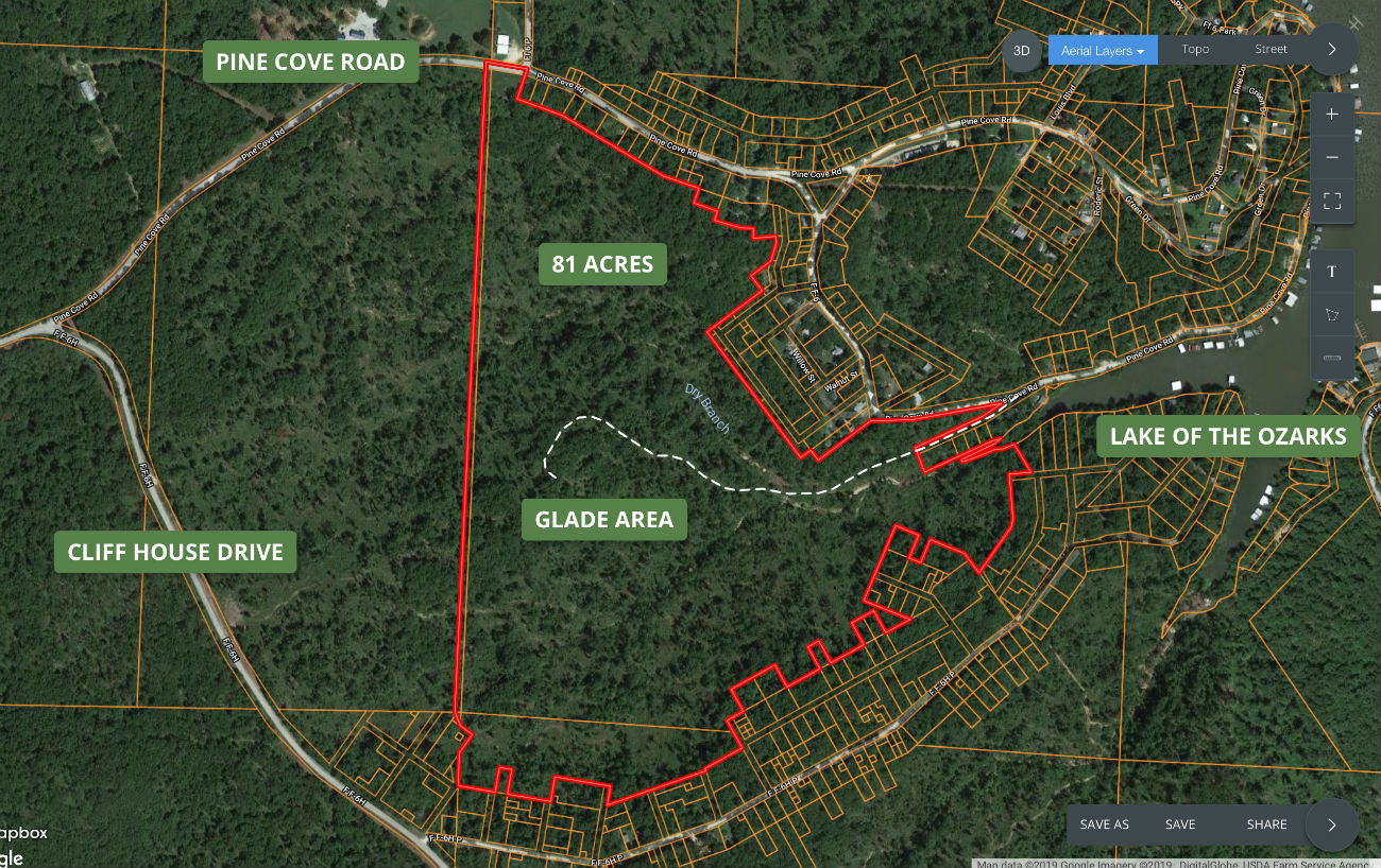
The map above is an aerial photo which shows the numerous small lots which border the 81 acres. These small lots would have been part of subdivisions that were mapped out decades ago. A few of the small lots have houses on them but most of them do not. These small lots are the reason that some of the 81 acres appears to have a “jagged” outline. – The 81 acres is composed of two adjoininging tracts. According to the County Assessor the north part is 74.4 acres and the south part is 6.6 acres, for a total of 81 acres.
.jpg)
The topo map above shows how the land “lays”. The property appears to be the highest in two spots: One of them would be the north end where it borders the paved road and the other would be just west of the “glade area” on the property. The property slopes down as you move away from these spots. This topo map does shows the small creek bed which runs easterly across the property which is labeled “Dry Branch”.
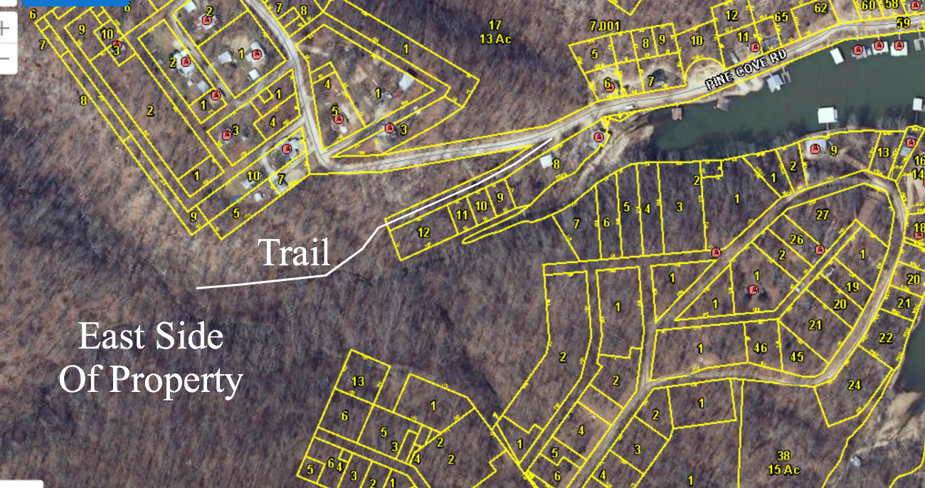
The photo above shows a closer view of the east side of the property. The white dotted line is a trail which comes off of the gravel road and leads back toward the glade area. With some cleanup it may be driveable with a truck but right now you would need a four wheeler or a side-by-side.
The above photo shows some of the adjoining properties at the east side of the 81 acres. The trail (still shown as the dotted line) actually follows an old surveyed roadway coming off of the gravel road, until it gets onto the property.
The map above is similar to the map before it, except that this is a winter aerial.
And the map above shows an even closer view than the previous couple of maps. As you can see in these winter aerials, the lake level is lower than in the summer.
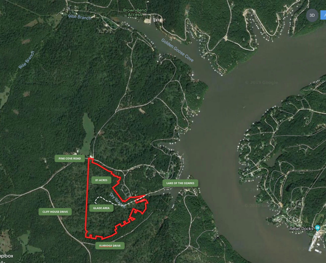
The map above shows some of the roads in the area as well as the Brown Bend Access to the Lake Of The Ozarks. You will see the Brown Bend Access at the top of the map. It is an awesome place to put your boat into the water and it even has a fishing pier and bathrooms. Best of all, it is free and is maintained by the State of Missouri.
The map above shows the route to the property from Climax Springs, Missouri.
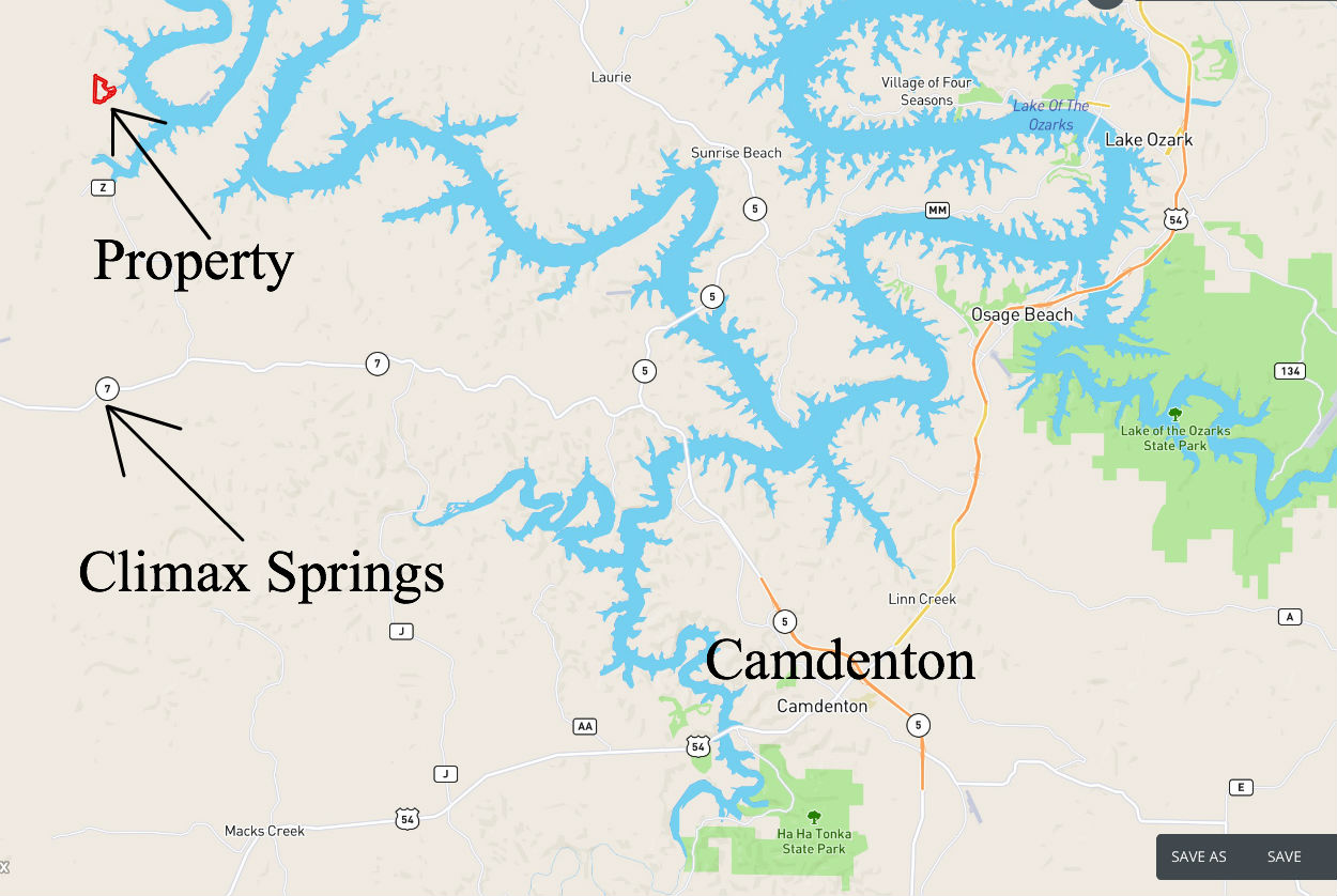
Camdenton, Missouri is the County Seat and is about 25 miles southeast of the property.
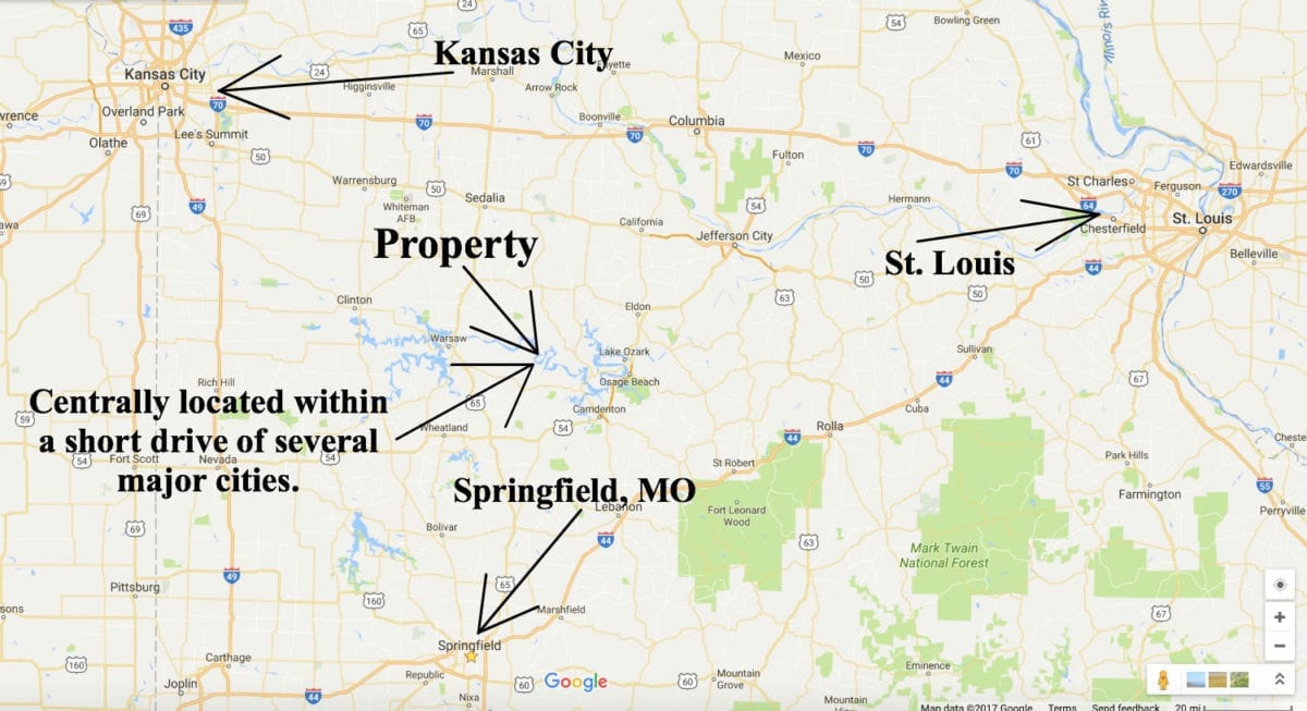
This large tract is centrally located within just a few hours drive of numerous major cities and airports. Whch makes it an excellent choice for a vacation property or full a year-around home!
The map above is yet another road map of the area.
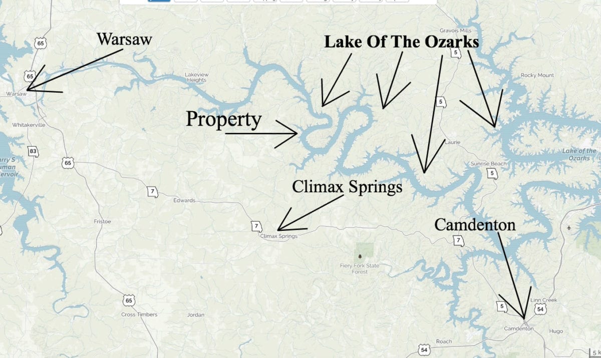
Camdenton would be the closest major town to the east and Warsaw, Missouri would be the closest major town to the west.
To get to the property from Camdenton take Highway 5 north for about 8 miles then go west onto Highway 7. Stay on Highway 7 for about 15 miles and pass through the town of Climax Springs. Go about 2-3 miles PAST Climax Springs then go north onto Highway DD. Stay on Highway DD for about 2-3 miles then go east onto Highway FF. Go 1-2 miles then go east onto Pine Cove Drive. Stay on Pine Cove Drive until you get to the intersection of Stoddard Lane and you will see the Fire Department on the left. On the right is the start of the property at the northern access point as show in maps above.
This is a LARGE property so please be sure to print out the maps from this listing so that you can really explore the acreage. The drive may be a little tricky on your first visit but if you have all of the maps and directions it will make it much easier. We will be happy to email you the maps/directions if you would like, just let us know.
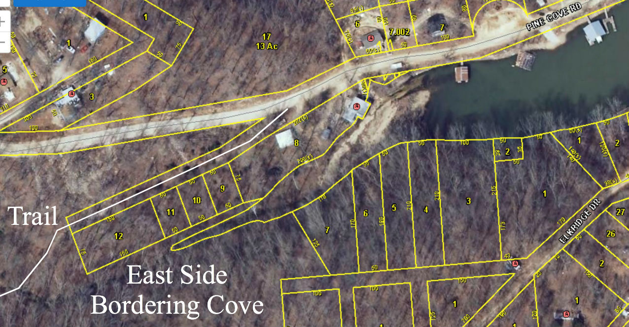
In the aerial photo above we are looking down on the eastern tip of the property at the cove. You can see the start of the little road which comes off of the gravel section of Pine Cove Road and leads back toward the 81 acres.
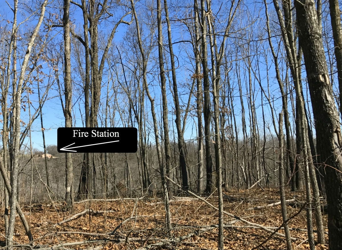
In the winter photo above we are standing just west of the glade area and we are looking to the north. In the distance, you can actually see the Fire Station that sits across the road from the north end of the property.
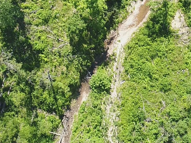
The aerial photo above shows the small creek on the property.
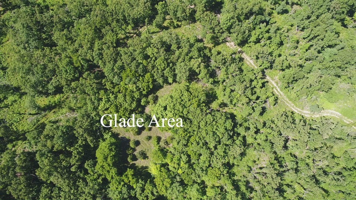
In the aerial photo above you can see one of the trails on the property which leads up to the glade area.
The sales price on this 81 acres is $119,500. As you know, most of our properties are available with a $500 down payment but on this LARGE tract the minimum down payment is $1,500. With $1,500 down the interest rate will be 7 3/4% and the payment will be $1,115 a month. With $2,500 down the interest rate drops to 6 3/4% and the payment drops to $1,040 a month. With $5,000 down the interest rate drops to 5 3/4% and the payment drops to $995 a month. These payments are all based on about a 15 year payment schedule. Property taxes are onlyabout $285 a year and are current. There are no prepayment penalties, no hidden fees and no balloon payments.
PLEASE NOTE that you have a full 12 months to ADD to your down payment in order to reduce your interest rate and payment amount!
We do need a minimum down payment of $1,500 on this huge tract of land and with your down payment you will automatically get the reduced interest rate of 7 3/4%.
If this is the property for you then please choose your initial down payment amount in the box below but PLEASE NOTE we do need a minimum down payment of $1,500 on this tract. If you accidentally select the $500 Down Payment option then we will contact you for the balance prior to taking the property off of the market. Also please feel free to give us a call and we can answer any questions or complete the transaction over the phone.


